Braille Maps
4 braille maps are installed on the Main and Centennial Campus, details are as follows:
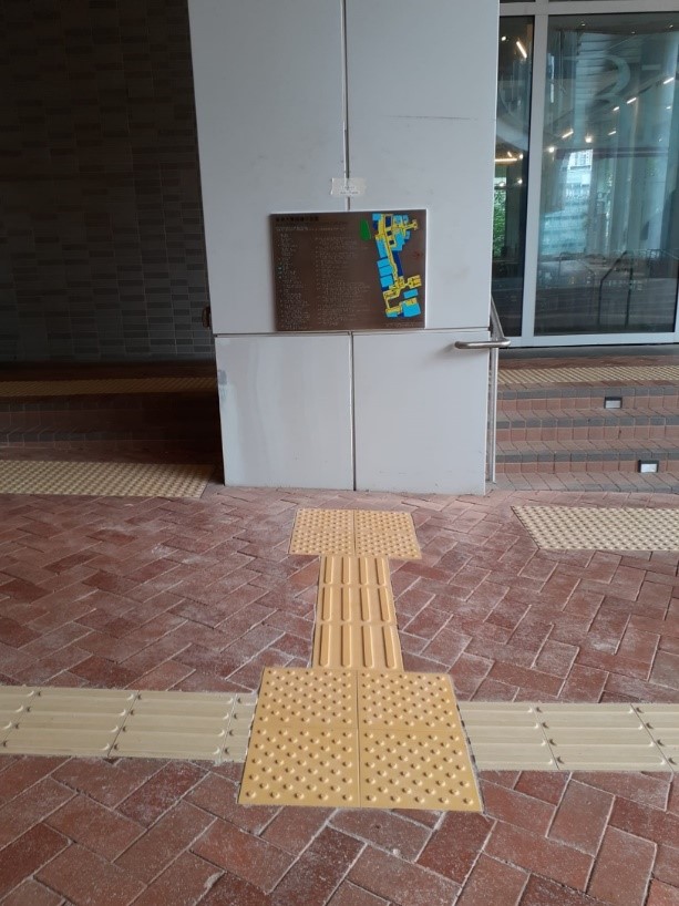
Map A: G/F Centennial Campus near the entrance of Run Run Shaw Building
This map covers tactile paths on Upper University Street in the western area of campus from Haking Wong Building to Centennial Campus
- How to access:
i. take Exit C1 at HKU MTR station, take the footbridge to HKU;
ii. take the lift at Centennial Gate to G/F;
iii. follow the tactile path until you reach the next patch of positional tiles, then make a right turn; iv. turn left at the next patch of positional tiles, then follow the tactile path;
v. turn right at the next patch of positional tiles and you will reach the map at the next patch of positional tiles.
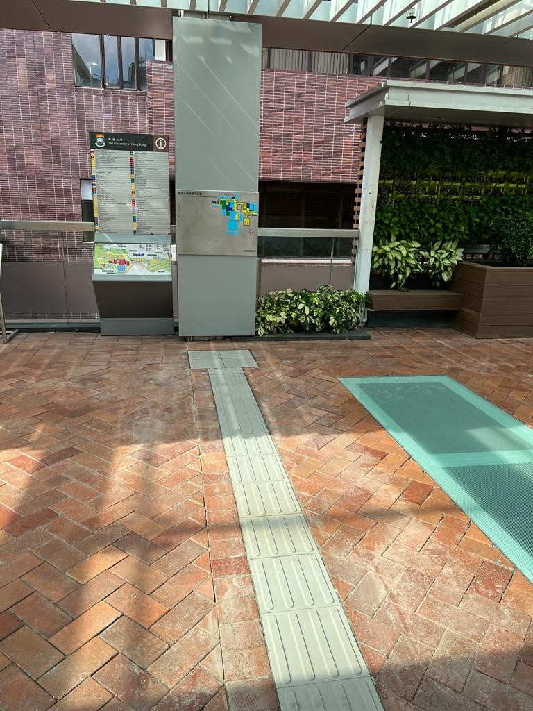
Map B: Upper University Street outside 5/F Haking Wong Building
This map covers tactile paths on Upper University Street in the central area of campus from Chong Yuet Ming Amenities Centre to Composite Building
- How to access:
i. take Exit A1/2 at HKU MTR Station and go to the FB (footbridge) level; ii. get out from the lift and follow the tactile path to reach a large patch of 12 positional tiles;
iii. turn right and move slightly forward to the last positional tiles, then turn left;
iv. follow the tactile path through the footbridge until you reach the next patch of positional tiles, then make a
right turn;
v. follow the tactile path until you reach at the next 2 patch of positional tiles;
vi. make a left turn and you will reach the map at the next patch of positional tiles.
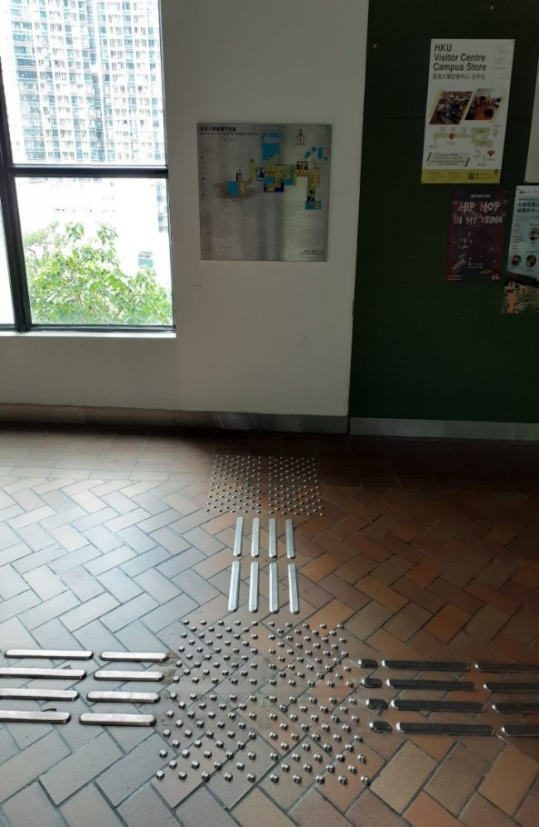
Map C: Footbridge between Knowles Building and KK Leung Building
This map covers the tactile paths on northern area of campus from Library Extension/ Hui Oi Chow Building to KK Leung Building/ Chong Yuet Ming Amenities Centre
- How to access:
i. take Exit A1/2 at HKU MTR Station and go to the FB (footbridge) level; ii. follow the instruction to go to map B;
iii. follow the instruction in map B to go to number 12 “to G/F Sun Yet-sen Place” using escalator/ lift;
iv. if you take escalator, turn right at the next patch of positional tiles and follow the tactile path until you reach
the next patch of positional tiles;
v. if you take lift, keep going straight at the next patch of positional tiles and follow the tactile path until you
reach the next patch of positional tiles;
vi. make a left turn and follow the tactile path, in where you will come across some gratings, then turn right at the
next patch of positional tiles;
vii. follow the tactile path until you 2 big patches of warning tiles, locate the tactile path on the left of the second
patch, and follow that tactile path;
viii. keep going until you reach the next patch of positional tiles, turn left and keep going until you reach the next
patch of positional tiles again, then turn right;
ix. follow the tactile path until you reach the next patch of positional tiles, make a right turn and you will reach
another patch of warning tiles;
x . lean left and follow the upslope ramp until you reach the next patch of positional tiles (with warning tiles on
the side), follow the tactile path until the next patch of positional tiles, then make a right turn;
xi. keep going until the next patch of positional tiles, turn left and keep going again;
xii. turn left at the next patch of positional tiles and you will reach the map in a few steps
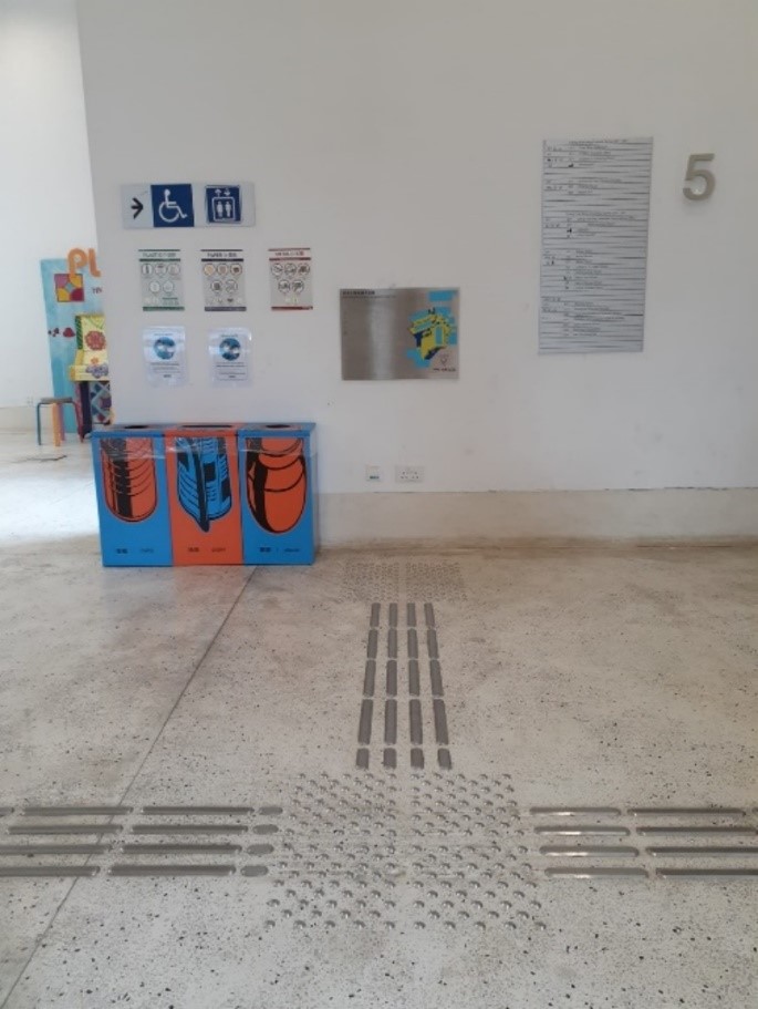
Map D: 5/F Chong Yuet Ming Amenities Centre
This map overs tactile paths on the upper Eastern part of campus from Chong Yuet Ming Amenities Centre to May Hall, Eilot Hall and Chong Yuet Ming Physics/ Chemistry Building
- How to access:
i. take Exit A1/2 at HKU MTR Station and go to the FB (footbridge) level; ii. follow the instruction to go to map B;
iii. follow the instruction in map B to go to number 7 “2/F Chong Yuet Ming Amenities Centre”;
iv. take the lift at number 8 to go to the 5/F, get out from the lift and turn right at the second patch of positional
tiles;
v. you will reach the map in a few steps.
 |
 |
| Map A: G/F Centennial Campus near the entrance of Run Run Shaw Building | Map B: Upper University Street outside 5/F Haking Wong Building |
 |
 |
|
Map C: Footbridge between Knowles Building and KK Leung Building |
Map D: 5/F Chong Yuet Ming Amenities Centre |
